
全部拍賣 / Books, Maps & Manuscripts / Italy - Piedmont

Italy - Piedmont
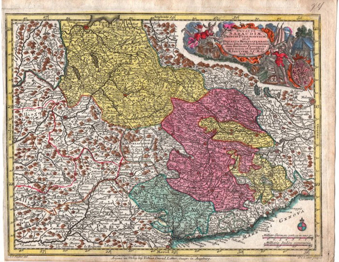
This image shows a splendid historic geographic map of the Savoy States, engraved on copper with period coloring. Details of the work • Title in the cartouche: Ducatus Sabaudiae, Principatus Pedemontium ut et Ducatus Montisferrati. The map describes in detail the territories of the Duchy of Savoy, the Principality of Piedmont, and the Duchy of Monferrato. • Cartographer and Engraver: The original map was initially conceived by famous cartographers such as Johann Baptist Homann and refined by Matthäus Seutter. In this specific variant, the publication details at the bottom indicate Augsburg (Augusta) by Tobias Conrad Lotter (father-in-law and successor of Seutter). • Period: Dated to the mid-18th century (circa 1750–1760). • Artistic elements: In the upper right corner stands a rich allegorical cartouche animated by mythological figures, noble crests, and soldiers surrounding the title. The different territories and political entities are differentiated by a lively and contrasting period aquatint. The names of the towns on the map are written in Latin, French, or eighteenth-century historical spellings. Below are the main cities identified, divided by geographic area and map color, with the historic name shown on the engraving and the corresponding modern name: 1- Piedmont Area (Colored in pink/fuchsia) It is the central portion of the map, the heart of the mainland Savoyard dominions: • Augusta Taurinorum / Turin ➔ Turin (the capital, clearly indicated along the Po River with star forts). • Fossan ➔ Fossano • Coni ➔ Cuneo • Vercelli ➔ Vercelli • Biella ➔ Biella • Ivrea ➔ Ivrea • Saluces ➔ Saluzzo • Pignerol ➔ Pinerolo • Cherasco ➔ Cherasco 2- Duchy of Monferrato and eastern areas (Colored in Yellow/Light Green) Moving eastward, between Piedmont and Lombardy: • Casal ➔ Casale Monferrato (capital of Monferrato). • Alba ➔ Alba • Asti ➔ Asti • Alexandria ➔ Alessandria • Novara ➔ Novara • Milano ➔ Milan (visible at the far right edge of the map, outside Savoy territory). Nizza (Nice), Liguria, and the Coast (Colored in Dark Green at the bottom) The map extends down to the Ligurian Sea: • Nizza / Nicaea ➔ Nice (at the time an integral part of the Savoy State). • Monaco Princip. ➔ Principality of Monaco (adjacent). • Genova ➔ Genoa (clearly indicated at the bottom right under the Genoa Republic emblem). • Savona ➔ Savona • Finale ➔ Finale Ligure 3- Duchy of Savoy and Alpine areas (Colored in Green at the top left) The cradle of the dynasty, located beyond the Alps (present-day France and Switzerland): • Chambery ➔ Chambéry (the historic capital of the Duchy of Savoy). • Geneve ➔ Geneva (visible at the top edge, near Lake Geneva). • Annecium ➔ Annecy SEUTTER, Georg Matthaus (1678-1757). Atlas Minor praecipua Orbis terrarum Imperia, Regna et Provincias Germania. Augsburg: Seutter, A.C. Seutter delin. Andr. Silbereisen Sculps. (to accompany) Atlas minor praecipua orbis terrarum imperia. by Seutter, Matthaeus, 1678-1756; Weyerman, Jacob Christoph; Seutter, Albrecht Carl, 1722-1762; Silbereisen, Andreas, 1673-1766 Print size: 19.5 x 25.5 cm at the marginal line, sheet size 21.5 x 27.5 cm Not shipped to the United States.
估價:$168.06
前往拍賣頁查看所有物品來自Catawiki或Books, Maps & Manuscripts
估價:
$168.06
類似物品





類似物品的拍賣結果
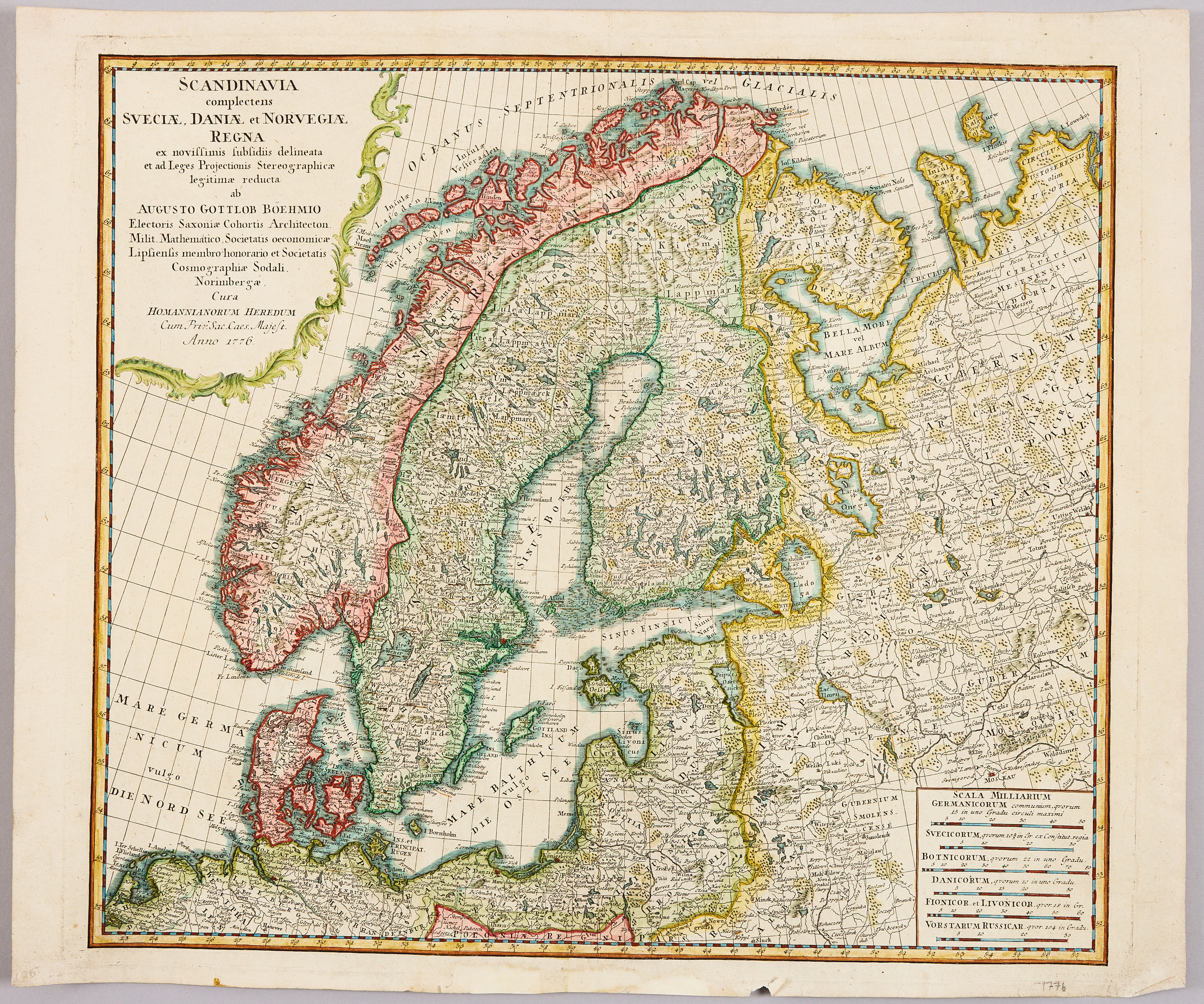
HOMANNS ARVINGAR, KARTA ÖVER SKANDINAVIEN, ca 1770.
10/09/2026
$110.1
估價: $120.35


讓您的拍賣觸及全球收藏家!
立刻發佈上架